1926 Map of the South African Union | Namibia | Lesotho | Botswana | Eswatini | Zimbabwe | Lithograph Map | Sud Afrika | Geography Poster
🌱🗺️ About This Historical Map:
* Published by Edward Stanford Ltd. in 1926 in London, Uk
* This map depicts the infrastructural, political, and topographical features of the South African Union
* The map represents current-day South Africa, Lesotho, Eswatini, Botswana, Namibia, and part of Zimbabwe
* Shows Political boundaries, cities, railways, bodies of water, drainage, coastlines, and islands.
* Colored lithograph map
* Frames *not* included
🖼️ Premium Print Options:
1. Hahnemühle German Etching Paper: • 310 gsm, 100% alpha-cellulose paper • Matte-textured surface for a fine art feel • Archival quality for long-lasting prints
2. Moab Lasal Exhibition Luster 300 Paper: • 300 gsm, resin-coated photographic paper • Slight gloss finish for vibrant color reproduction • Excellent for detailed image rendering Both feature fade-resistant inks for lasting vibrancy!
🏅 Why Choose TarruNadi Prints:
* Meticulously reproduced from high-resolution scans
* Professionally printed to order
* Fast processing time: 3-7 business days
* Secure packaging to ensure safe delivery
🎁 Perfect For:
* Descendants of Germany
* People curious about historical astronomy
* Lovers of historical documents
* Cartography enthusiasts
* Environmental scientists and students
* Educators
* Vintage diagram collectors
* Libraries and educational institutions
* Historians and geographers
🚚 Shipping:
* Carefully rolled and shipped in a sturdy tube
* Tracked shipping available
* Please allow 1 week for delivery depending on location
🫱🏾🫲🏽 About the Seller: Saki Savavi here, the creative curator force behind TarruNadi. TarruNadi is a shop dedicated to offering reimagined and redesigned historical maps, as well as a curated selection of artisanal crafts from around the world. Our shop is a haven for the worldly, the global citizen, the land steward, and those reverent of Earth's ecology. We celebrate the interconnectedness of leylines and psychogeography, providing items that enhance your experience and connection to the world.
🔗 Explore More:
* Visit the website: https://sakisavavi.earth
* Follow me on Instagram: instagram.com/sakisavavi
💯 Our Promise: We're committed to your satisfaction. If you have any issues with your order, please contact us within 14 days of receipt, and we'll make it right.

 Image 1 of 10
 Image 2 of 10
 Image 3 of 10
 Image 4 of 10
 Image 5 of 10
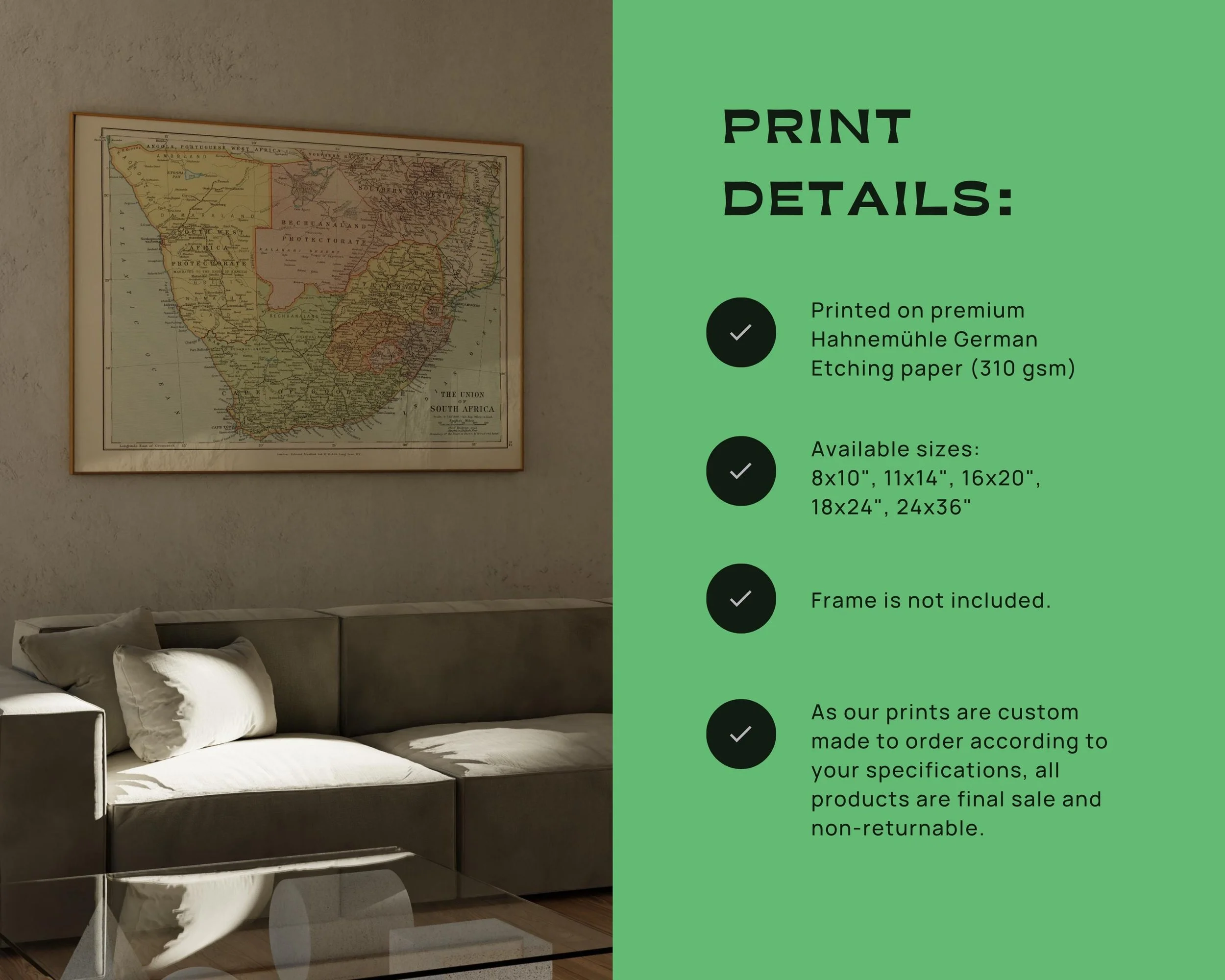 Image 6 of 10
 Image 7 of 10
 Image 8 of 10
 Image 9 of 10
 Image 10 of 10