1959 Map of Sri Lanka and Indian Ocean | Ceylon Cartography | Mid-Century Artwork | Classic Geography
🌱🗺️ About This Historic Map:
* Published in 1959 by Houghton Mifflin Co. and John Bartholomew & Son LTD.
* This detailed historic map exhibits a typical mid-20th-century cartographic style, characterized by clear delineation of political boundaries, meticulous labeling of geographical entities, and a balanced use of colors to distinguish between land and water, as well as different types of terrain.
* Authored by John Bartholomew
* Textured archival map
* Frames *not* included
* We do our best to heal these reproductions of delicate cartographies but please understand they will have minor defects from weathering of the original maps.
🖼️ Premium Print Options:
1. Hahnemühle German Etching Paper: • 310 gsm, 100% alpha-cellulose paper • Matte-textured surface for a fine art feel • Archival quality for long-lasting prints
2. Enhanced Matte Paper: • 200 gsm, resin-coated photographic paper • Slight gloss finish for vibrant color reproduction • Excellent for detailed image rendering Both feature fade-resistant inks for lasting vibrancy!
🏅 Why Choose TarruNadi Prints:
* Meticulously reproduced from high-resolution scans
* Professionally printed to order
* Fast processing time: 3-7 business days
* Secure packaging to ensure safe delivery
🎁 Perfect For:
* Descendants of Sri Lanka and the Indian Ocean
* People curious about historical geography
* Lovers of hidden history
* Cartography enthusiasts
* Environmental scientists and students
* Educators
* Vintage diagram collectors
* Libraries and educational institutions
* Historians and geographers
🚚 Shipping:
* Carefully rolled and shipped in a sturdy tube
* Tracked shipping available
* Please allow 1 week for delivery depending on location
🫱🏾🫲🏽 About the Seller: Saki Savavi here, the creative curator force behind TarruNadi. TarruNadi is a shop dedicated to offering reimagined and redesigned historical maps, as well as a curated selection of artisanal crafts from around the world. Our shop is a haven for the worldly, the global citizen, the land steward, and those reverent of Earth's ecology. We celebrate the interconnectedness of leylines and psychogeography, providing items that enhance your experience and connection to the world.
🔗 Explore More:
* Visit the website: https://sakisavavi.earth
* Follow me on Instagram: instagram.com/sakisavavi
💯 Our Promise: We're committed to your satisfaction. If you have any issues with your order, please contact us within 14 days of receipt, and we'll make it right.
🏷️ Tags: 1931 soil map, francis j marschner, usda historical map, parent materials of soils, vintage agricultural map, us geology chart, antique map reproduction, soil science, american agriculture, environmental history, agricultural geology, pedology art, us soil distribution
1878 Comparative Map of Lakes | Lloyd’s Historical Maps of America | Reworked by Saki Savavi | Countercartography | Fine Art Print
🌱🗺️ About This Reworked Map:
* Authored by John Bartholomew in 1959
* Published by Houghton Mifflin Co. & Bartholomew & Son LTD in Boston and London
* Depicts topographical details of Syria, Lebanon, Jordan, Iraq
🖼️ Premium Print Options:
1. Hahnemühle German Etching Paper: • 310 gsm, 100% alpha-cellulose paper • Matte-textured surface for a fine art feel • Archival quality for long-lasting prints
2. Moab Lasal Exhibition Luster 300 Paper: • 300 gsm, resin-coated photographic paper • Slight gloss finish for vibrant color reproduction • Excellent for detailed image rendering Both feature fade-resistant inks for lasting vibrancy!
🏅 Why Choose TarruNadi Prints:
* Meticulously reproduced from high-resolution scans
* Professionally printed to order
* Fast processing time: 3-7 business days
* Secure packaging to ensure safe delivery
🎁 Perfect For:
* Descendants of the British Islands
* Cartography enthusiasts
* Environmental scientists and students
* Vintage map collectors
* Geography and Biology students
* Collectors of vintage artifacts
* Libraries and educational institutions
* Farmers and agricultural professionals
🚚 Shipping:
* Carefully rolled and shipped in a sturdy tube
* Tracked shipping available
* Please allow 1 week for delivery depending on location
🫱🏾🫲🏽 About the Seller: Saki Savavi here, the creative curator force behind TarruNadi. TarruNadi is a shop dedicated to offering reimagined and redesigned historical maps, as well as a curated selection of artisanal crafts from around the world. Our shop is a haven for the worldly, the global citizen, the land steward, and those reverent of Earth's ecology. We celebrate the interconnectedness of leylines and psychogeography, providing items that enhance your experience and connection to the world.
🔗 Explore More:
* Visit the website: https://sakisavavi.earth
* Follow me on Instagram: instagram.com/sakisavavi
💯 Our Promise: We're committed to your satisfaction. If you have any issues with your order, please contact us within 14 days of receipt, and we'll make it right.

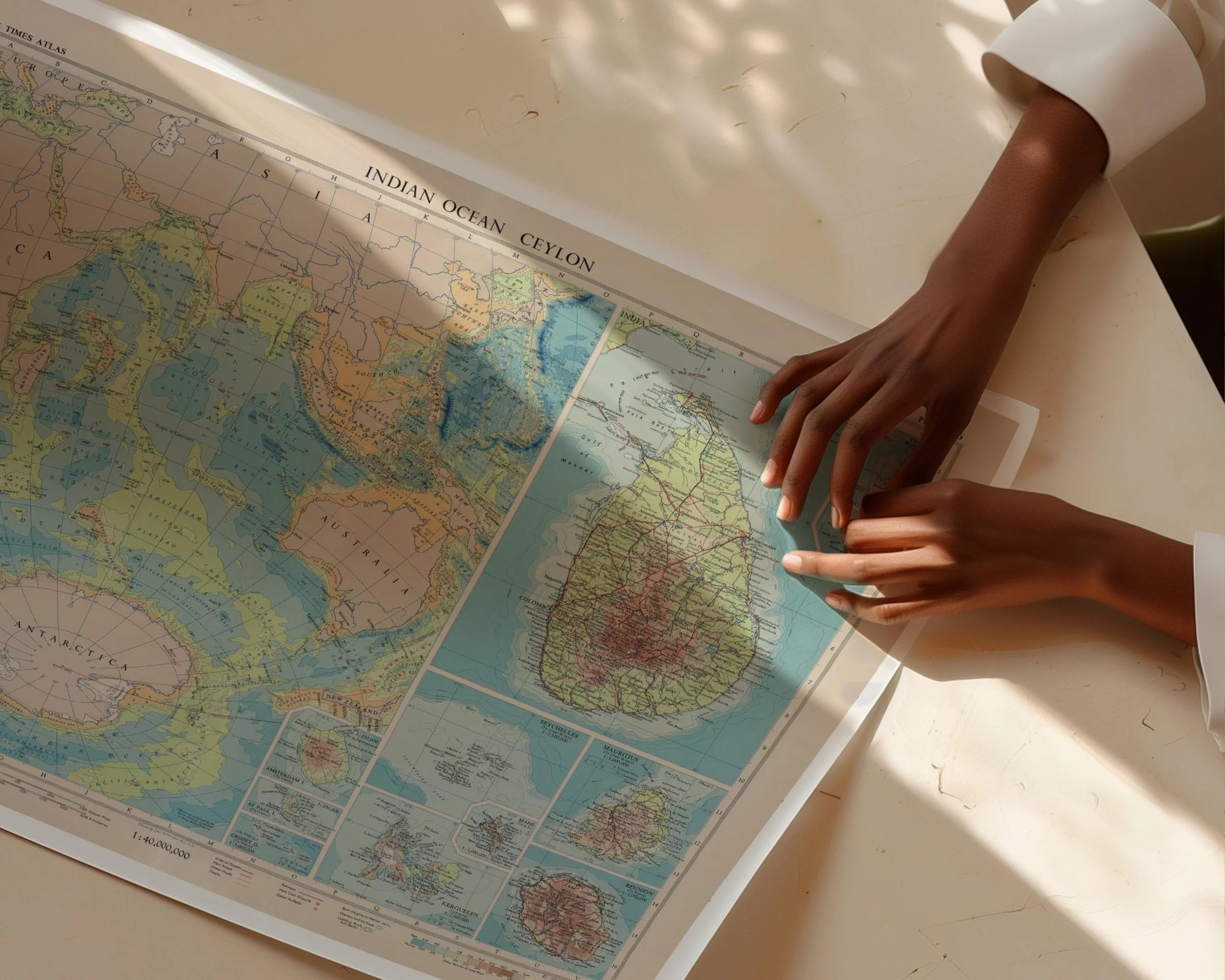 Image 1 of 11
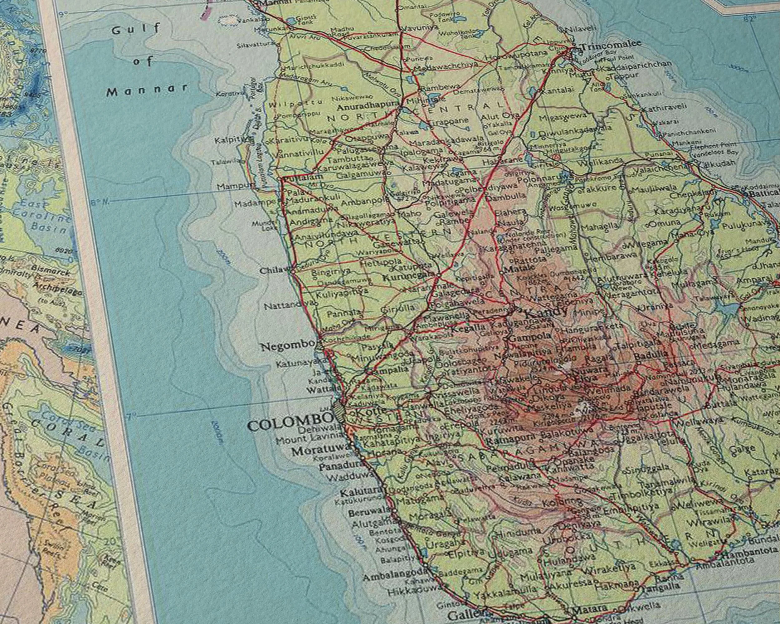 Image 2 of 11
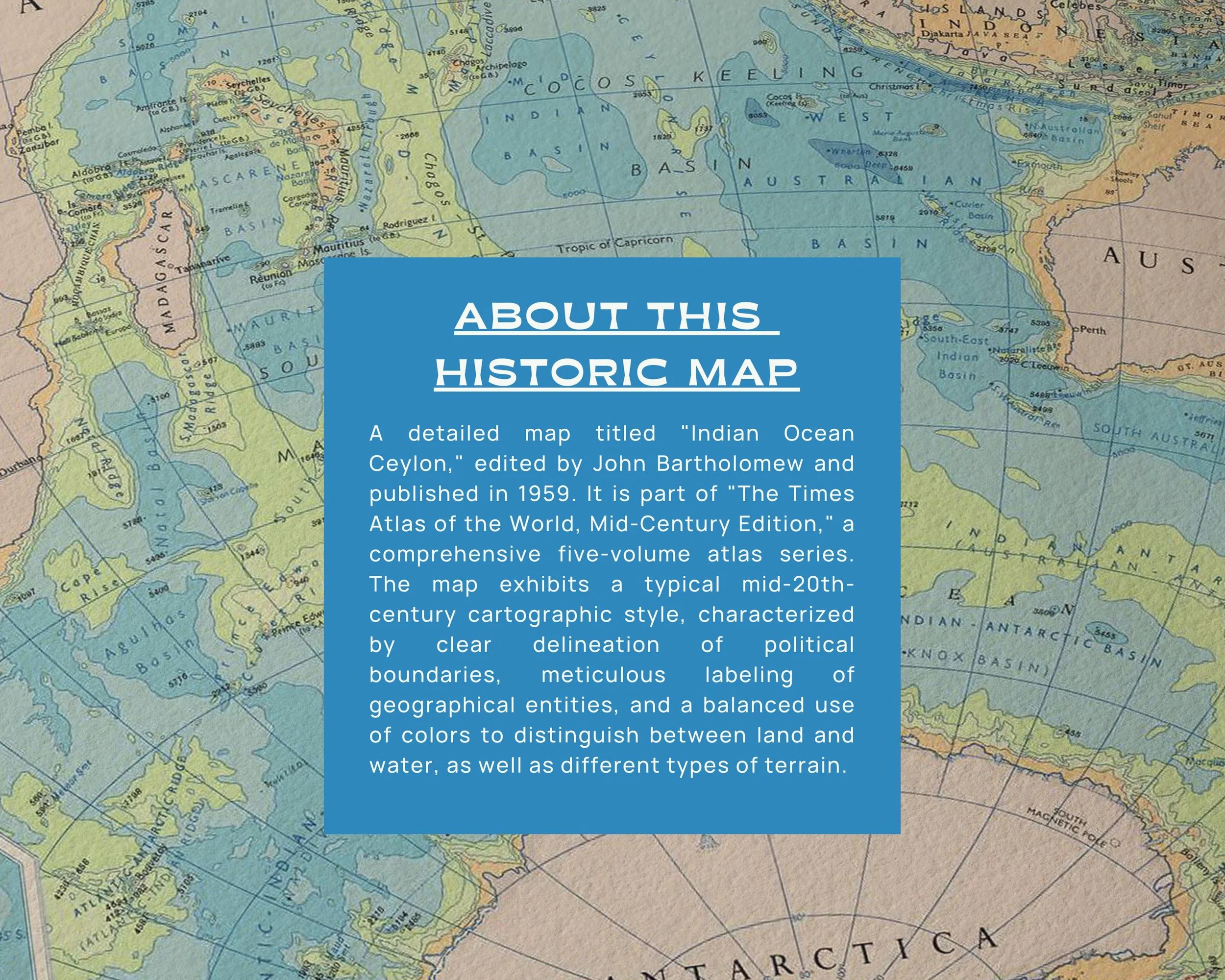 Image 3 of 11
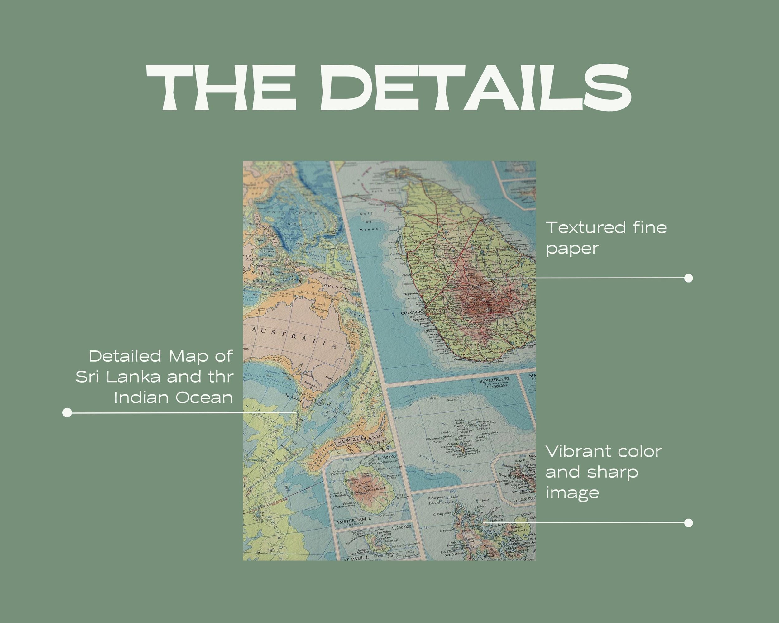 Image 4 of 11
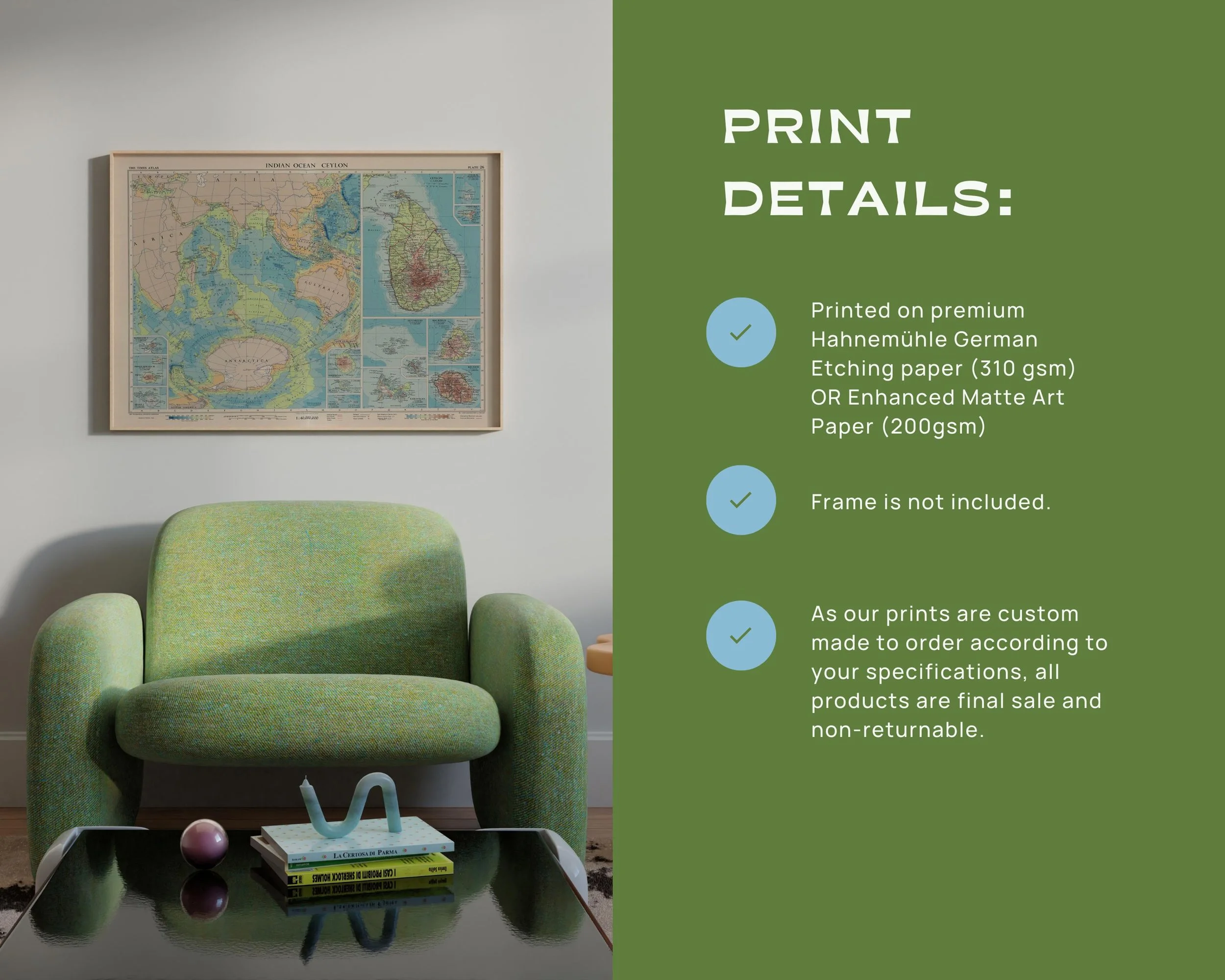 Image 5 of 11
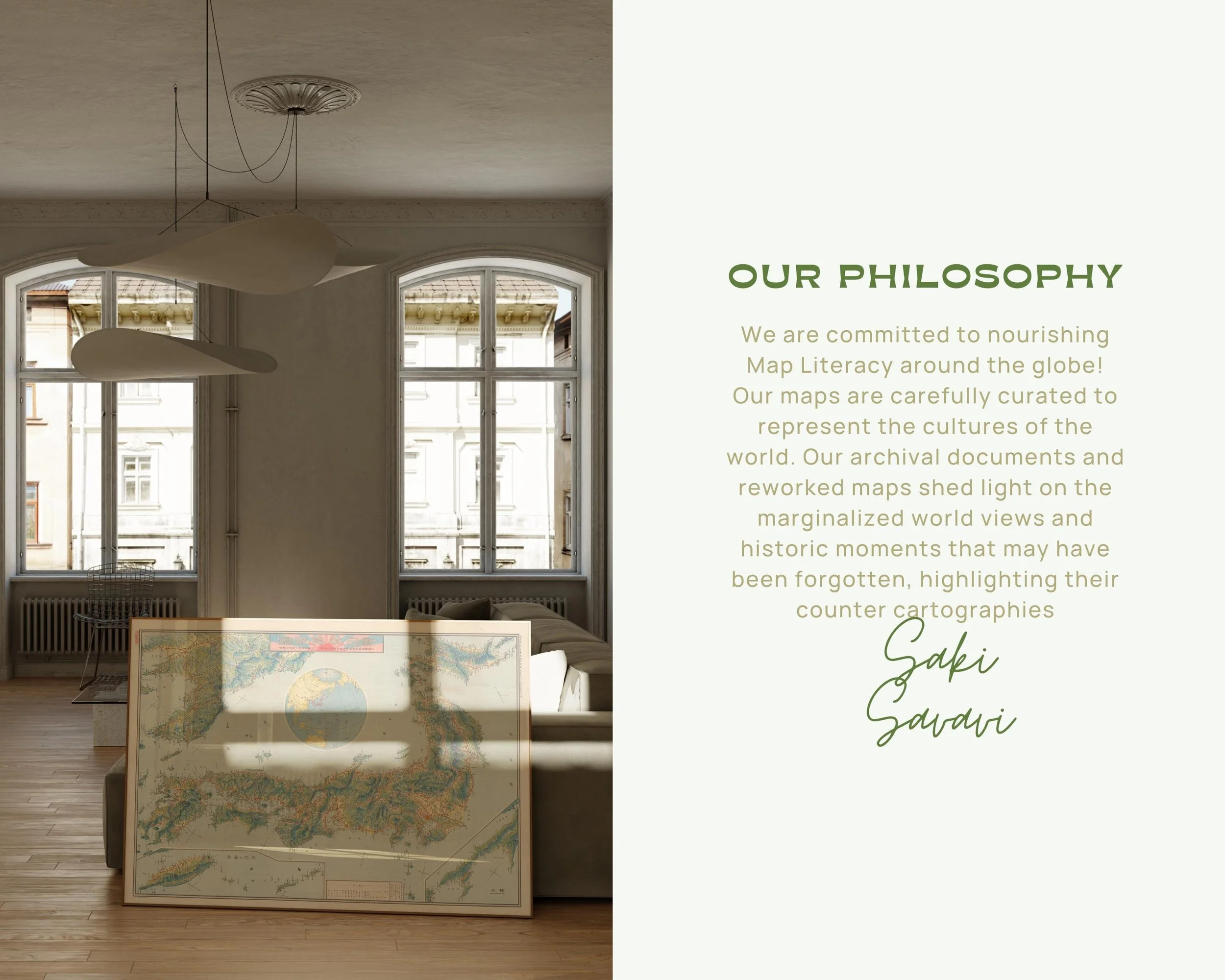 Image 6 of 11
 Image 7 of 11
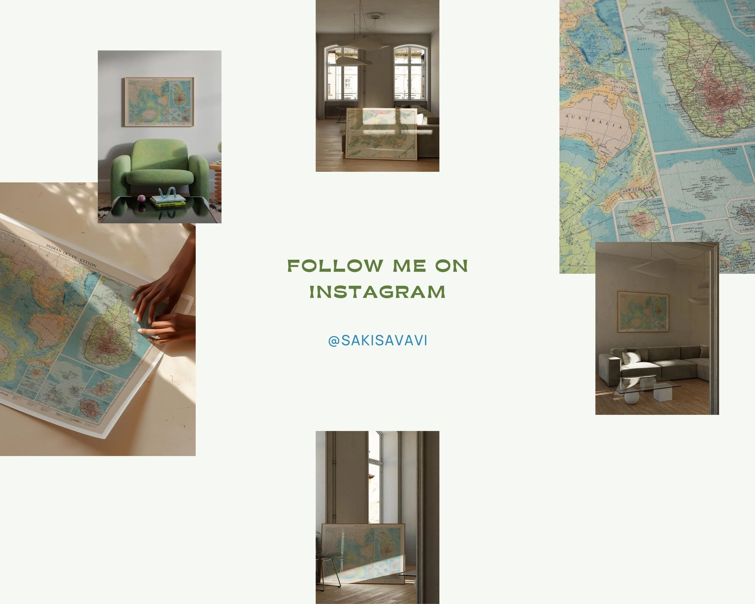 Image 8 of 11
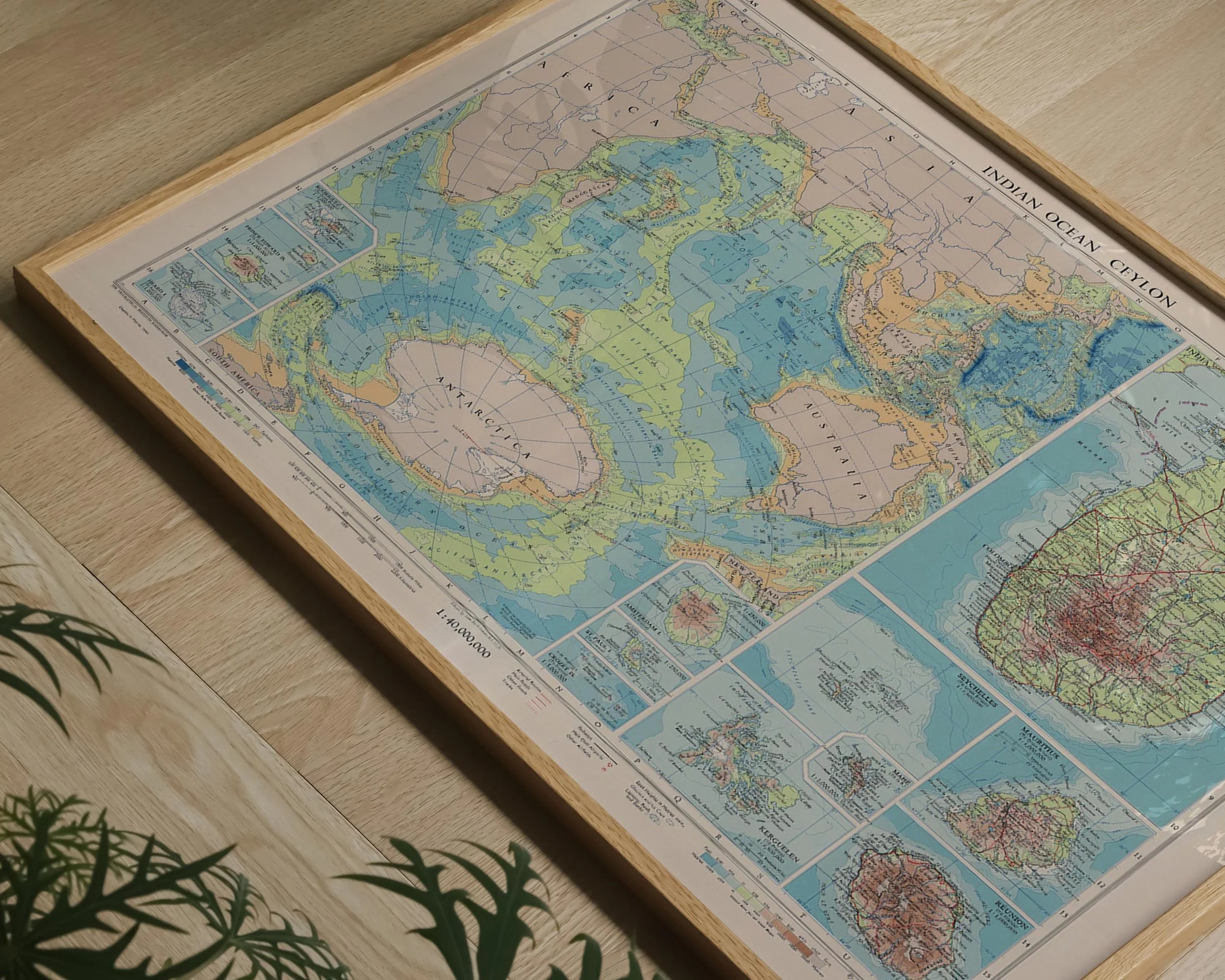 Image 9 of 11
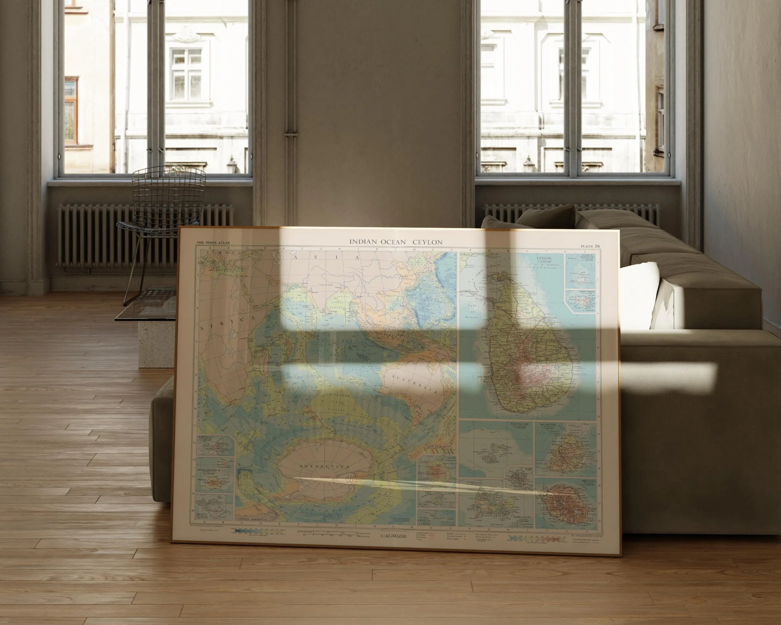 Image 10 of 11
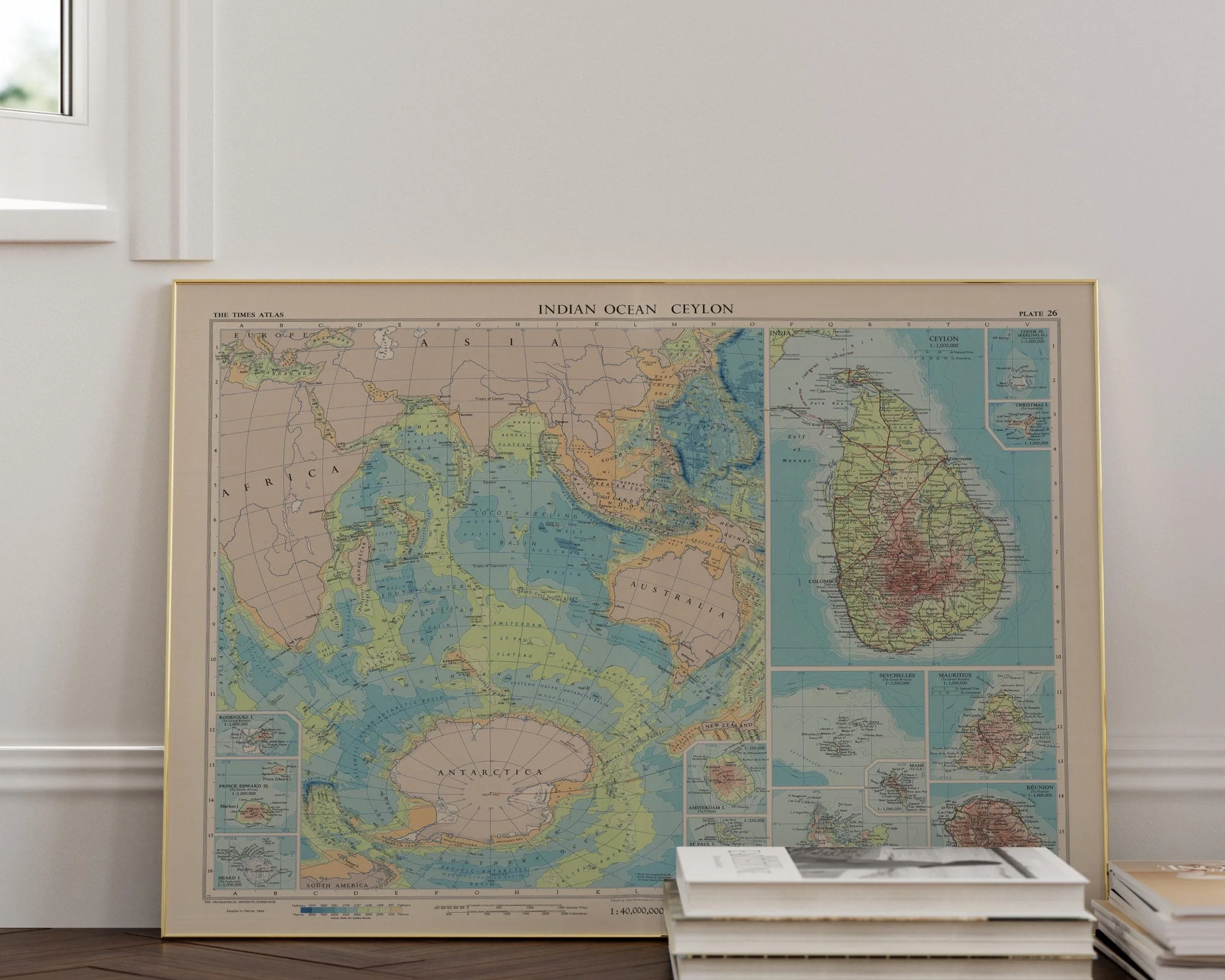 Image 11 of 11