Archival Map of World Hemispheres by Muhammad Ramzi 1910 | Classroom Poster | Wall Art | Arab Cartography | Ottoman Maps | Globe Maps
🌱🗺️ About This Historical Map:
* Published in 1910 by Maktab Tablet Matbaasi
* Created by Muhammad Ramzi
* Depicts a low embellishment map of the landmasses of the world as of 1910
* Frames *not* included
🖼️ Premium Print Options:
1. Hahnemühle German Etching Paper: • 310 gsm, 100% alpha-cellulose paper • Matte-textured surface for a fine art feel • Archival quality for long-lasting prints
2. Moab Lasal Exhibition Luster 300 Paper: • 300 gsm, resin-coated photographic paper • Slight gloss finish for vibrant color reproduction • Excellent for detailed image rendering Both feature fade-resistant inks for lasting vibrancy!
🏅 Why Choose TarruNadi Prints:
* Meticulously reproduced from high-resolution scans
* Professionally printed to order
* Fast processing time: 3-7 business days
* Secure packaging to ensure safe delivery
🎁 Perfect For:
* Descendants of Germany
* People curious about historical astronomy
* Lovers of historical documents
* Cartography enthusiasts
* Environmental scientists and students
* Educators
* Vintage diagram collectors
* Libraries and educational institutions
* Historians and geographers
🚚 Shipping:
* Carefully rolled and shipped in a sturdy tube
* Tracked shipping available
* Please allow 1 week for delivery depending on location
🫱🏾🫲🏽 About the Seller: Saki Savavi here, the creative curator force behind TarruNadi. TarruNadi is a shop dedicated to offering reimagined and redesigned historical maps, as well as a curated selection of artisanal crafts from around the world. Our shop is a haven for the worldly, the global citizen, the land steward, and those reverent of Earth's ecology. We celebrate the interconnectedness of leylines and psychogeography, providing items that enhance your experience and connection to the world.
🔗 Explore More:
* Visit the website: https://sakisavavi.earth
* Follow me on Instagram: instagram.com/sakisavavi
💯 Our Promise: We're committed to your satisfaction. If you have any issues with your order, please contact us within 14 days of receipt, and we'll make it right.
🏷️ Tags: 1931 soil map, francis j marschner, usda historical map, parent materials of soils, vintage agricultural map, us geology chart, antique map reproduction, soil science, american agriculture, environmental history, agricultural geology, pedology art, us soil distribution
1878 Comparative Map of Lakes | Lloyd’s Historical Maps of America | Reworked by Saki Savavi | Countercartography | Fine Art Print
🌱🗺️ About This Reworked Map:
* Originally created by Keith Alexander Johnston
* Original Published in 1854 by Willian Blackwood & Sons in Edinburgh
* Depicts detailed map of the qualities of the British Islands.
* Includes table of fossils recorded in the Scottish Strata, sort of flora and fauna found in the region.
🖼️ Premium Print Options:
1. Hahnemühle German Etching Paper: • 310 gsm, 100% alpha-cellulose paper • Matte-textured surface for a fine art feel • Archival quality for long-lasting prints
2. Moab Lasal Exhibition Luster 300 Paper: • 300 gsm, resin-coated photographic paper • Slight gloss finish for vibrant color reproduction • Excellent for detailed image rendering Both feature fade-resistant inks for lasting vibrancy!
🏅 Why Choose TarruNadi Prints:
* Meticulously reproduced from high-resolution scans
* Professionally printed to order
* Fast processing time: 3-7 business days
* Secure packaging to ensure safe delivery
🎁 Perfect For:
* Descendants of the British Islands
* Cartography enthusiasts
* Environmental scientists and students
* Vintage map collectors
* Geography and Biology students
* Collectors of vintage artifacts
* Libraries and educational institutions
* Farmers and agricultural professionals
🚚 Shipping:
* Carefully rolled and shipped in a sturdy tube
* Tracked shipping available
* Please allow 1 week for delivery depending on location
🫱🏾🫲🏽 About the Seller: Saki Savavi here, the creative curator force behind TarruNadi. TarruNadi is a shop dedicated to offering reimagined and redesigned historical maps, as well as a curated selection of artisanal crafts from around the world. Our shop is a haven for the worldly, the global citizen, the land steward, and those reverent of Earth's ecology. We celebrate the interconnectedness of leylines and psychogeography, providing items that enhance your experience and connection to the world.
🔗 Explore More:
* Visit the website: https://sakisavavi.earth
* Follow me on Instagram: instagram.com/sakisavavi
💯 Our Promise: We're committed to your satisfaction. If you have any issues with your order, please contact us wi

 Image 1 of 8
 Image 2 of 8
 Image 3 of 8
 Image 4 of 8
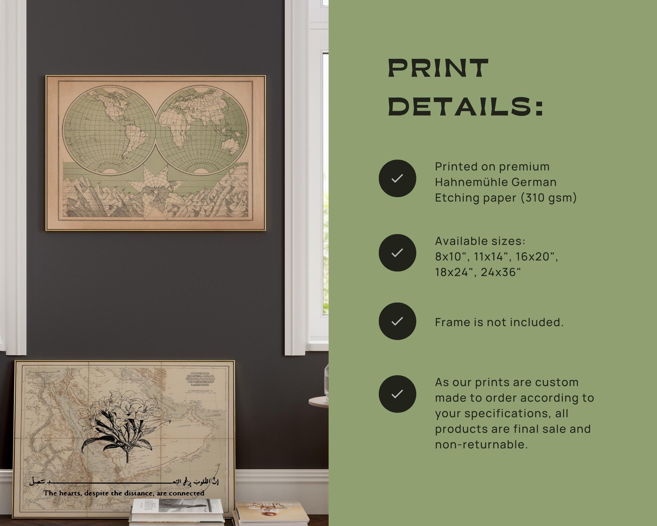 Image 5 of 8
 Image 6 of 8
 Image 7 of 8
 Image 8 of 8