Colonial and State Boundary Disputes 1932 | Charles O. Paullin | Cartography Art | Map Art | Cartography Print
from $48.00
This archival map made by Charles O. Paullin in 1932 depicts the Boundary and State Disputes for North + South Carolina, the Northern Boundary of Georgia, Maryland and Pennsylvania, and the Chesapeake Bay. Detailed for your intellectual pleasure.
Printed on high-quality Hahnemühle German Etching paper, known for its texture and velvet-like finish, this art print brings historical significance to any space you set it in.
**Frame not included**
Perfect for art collectors, history enthusiasts, map collectors and those interested in how America's State borders in the north East were formed

 Image 1 of 5
 Image 2 of 5
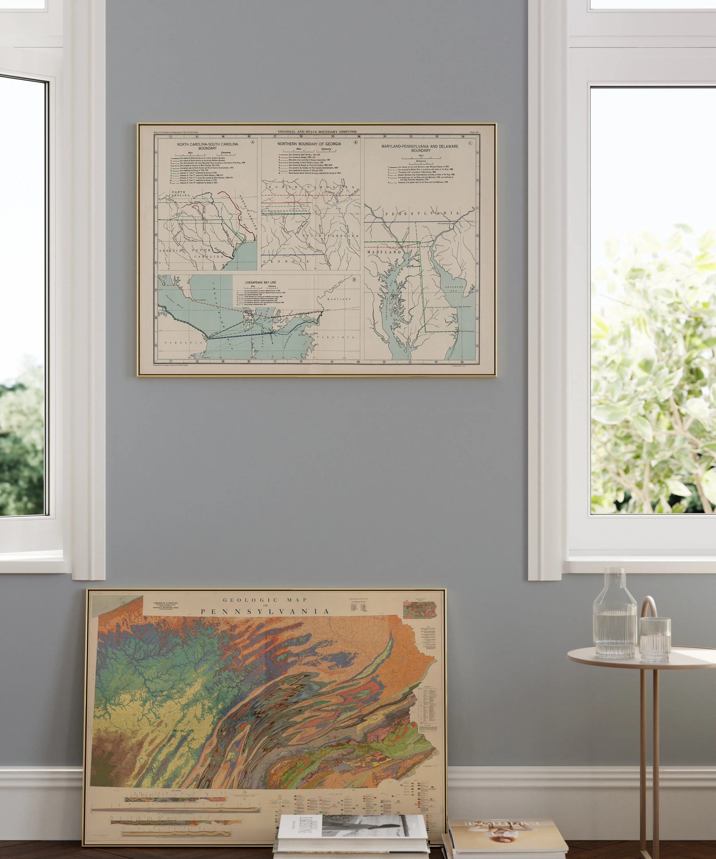 Image 3 of 5
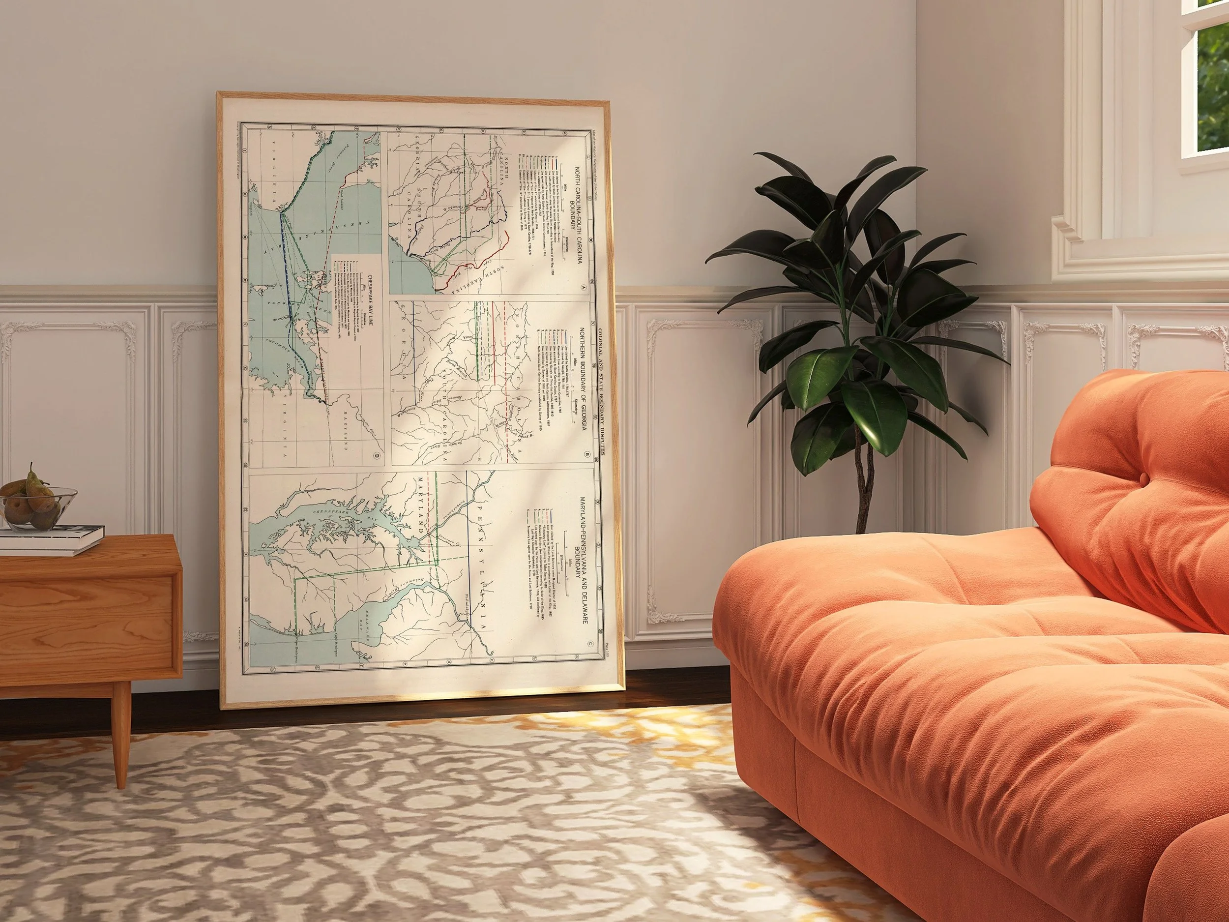 Image 4 of 5
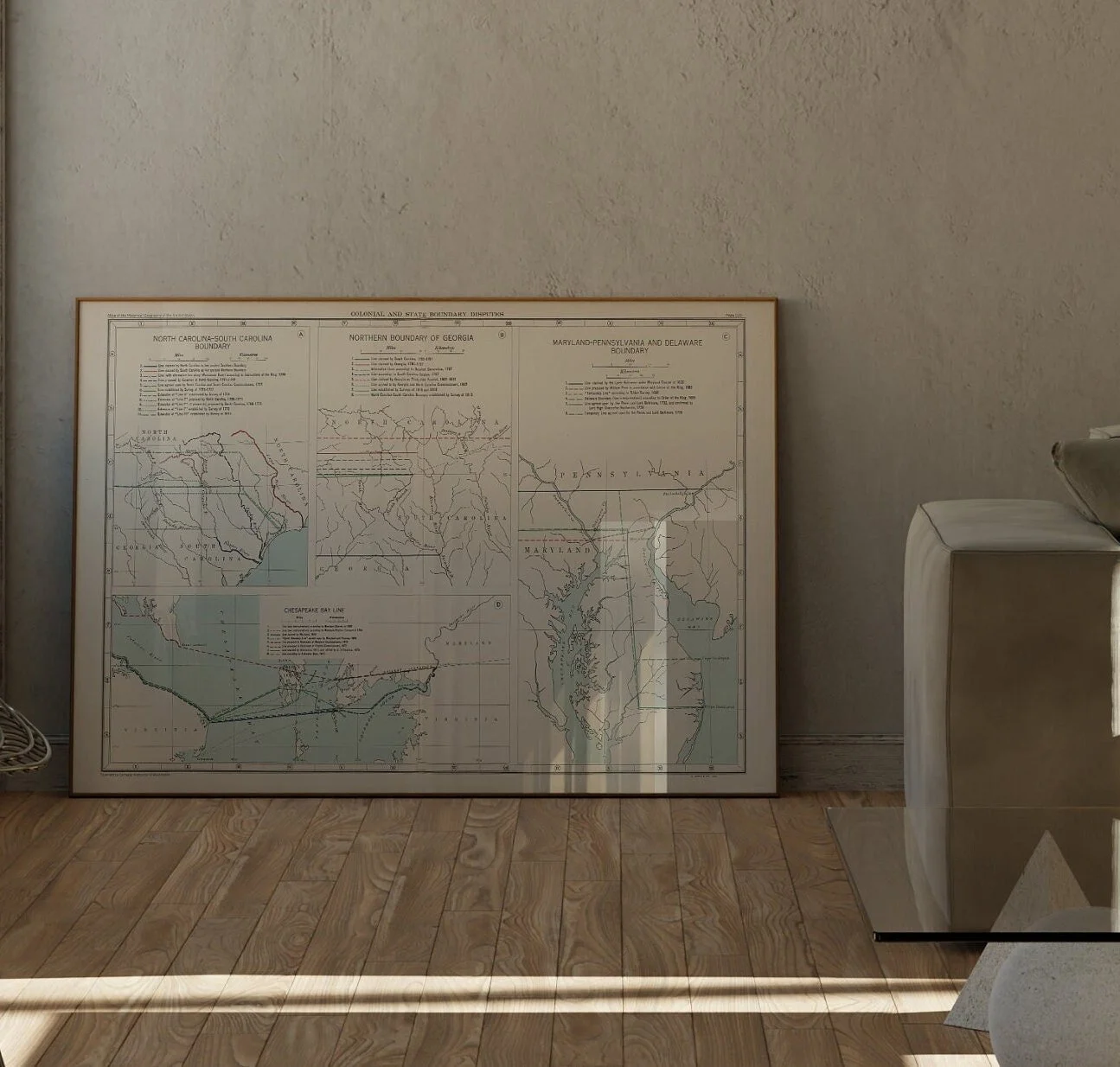 Image 5 of 5